Section 02 · The LandThe Record · Map Atlas
← The LandSection 02 · Short’s Resort Field Station
Map Atlas
Five plates of record. Every map in our manuals, grant files and field documents is drawn from these — so when one of them is wrong, everything downstream is wrong with it.
Map Atlas
Five plates of record. North is up on every one; lines are drawn from our own field plan, not a licensed survey — if one looks wrong, it probably is. Tell us. Move across the five below to change the plate.
 SR · M-01Enlarge ↖
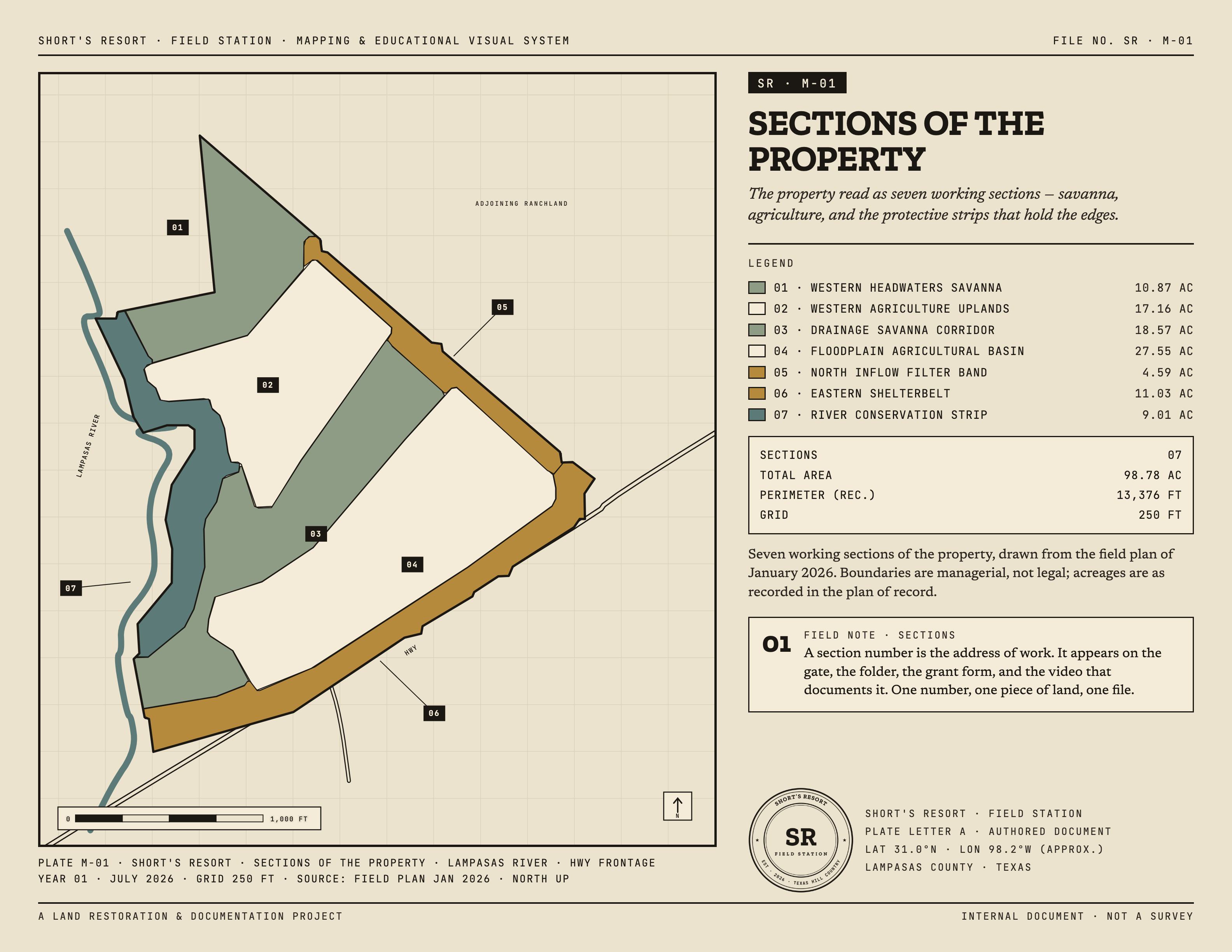
Plate SR · M-01
Sections of the Property
The master reference — seven working sections, from the Western Headwaters Savanna down to the River Conservation Strip, each keyed to the care classes below.
On the plates
Boundaries are managerial, not legal; acreages are as recorded in the plan of record. North is up on every plate. Care classes run riparian & hydrologic, woody & shelter, and agricultural.
The flood plate is adapted from the Lampasas CAD web map and is informational only — never use it for an insurance determination. If a line looks wrong to you, it probably is; tell us and we’ll check it.